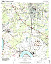
1998 Map of Gonzales
USGS Topo · Published 2001About this map
The Mississippi River makes a dramatic turn around Point Houmas at the southern edge of this map, anchoring a landscape where river commerce meets inland development. The settlement of Gonzales serves as the primary hub, surrounded by a dense network of educational and spiritual centers including Ascension College, East Ascension High School, and numerous community landmarks like Sacred Heart of Mary Ch. Industrial and agricultural legacies are visible through the large Tailings Ponds near the Panama Canal and the Illinois Central Railroad corridor that bisects the terrain.
Find a feature on this map
68 named features on this map. Tap any name to fly to it.
Don’t see what you’re looking for? This feature index may not catch every label — zoom into the map to look around manually.
Map Details
Editions of this 1998 Gonzales Map
This is the sole edition of this map. No revisions or reprints were ever made.
Other maps of this area

1892 · Donaldsonville
USGS Topo · 1:62,500

1908 · Baton Rouge
USGS Topo · 1:62,500

1934 · Denham Springs
USGS Topo · 1:62,500

1935 · Gonzales
USGS Topo · 1:31,680

1936 · White Castle
USGS Topo · 1:62,500

1939 · Denham Springs
USGS Topo · 1:62,500

1939 · Baton Rouge
USGS Topo · 1:62,500

1939 · Donaldsonville
USGS Topo · 1:62,500

1946 · Convent
USGS Topo · 1:31,680

1947 · Donaldsonville
USGS Topo · 1:31,680