Loading...
Loading map...2022 Map of Goochland
USGS Topo · Published 2022About this map
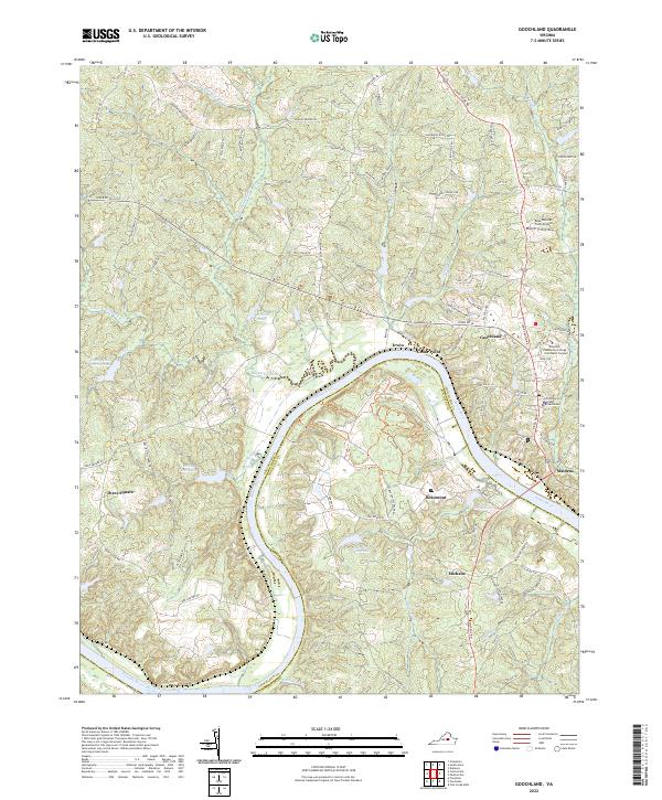
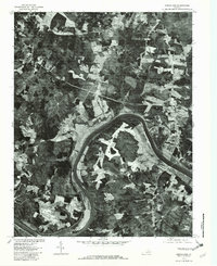
The James River winds through this central Virginia landscape, defining the border between Goochland and Powhatan counties. The community of Goochland serves as the focal point, anchored by the Goochland County Courthouse and the Reynolds Community College - Goochland Campus. The river's path is marked by distinctive features such as Horseshoe Bend and the small settlements of Maidens, Irwin, and Cedar Point that line its banks.
Find a feature on this map
90 named features on this map. Tap any name to fly to it.
Don’t see what you’re looking for? This feature index may not catch every label — zoom into the map to look around manually.
Map Details
Date Portrayed2022
Date Published2022
PublisherU.S. Geological Survey
Map TypeTopographic
Scale1:24000
Physical Dimensions24 x 29 inches
Editions of this 2022 Goochland Map
This is the sole edition of this map. No revisions or reprints were ever made.
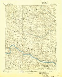
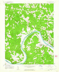
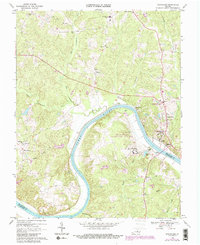
Historical Maps of Maidens Through Time
6 maps found

Featured Locations
Source Details
SourceU.S. Geological Survey
CopyrightPublic Domain