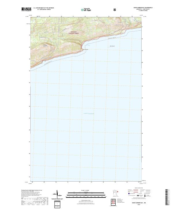
2022 Map of Good Harbor Bay
USGS Topo · Published 2022About this map
The Sawtooth Mountains rise sharply above the North Shore of Lake Superior, creating a dramatic topographical transition within the Superior National Forest. This modern survey illustrates the interface between the lake’s vast waters and the upland forest, where drainage systems like Bally Creek, Cut Face Cr, and the Fall River carve through the landscape toward the shoreline. The primary transportation corridor, Minnesota Highway 61, follows the natural curve of the coast, connecting local access points such as Pike Lake Road and Cardinal Road to the waterfront.
Find a feature on this map
28 named features on this map. Tap any name to fly to it.
Don’t see what you’re looking for? This feature index may not catch every label — zoom into the map to look around manually.
Map Details
Editions of this 2022 Good Harbor Bay Map
This is the sole edition of this map. No revisions or reprints were ever made.
Other maps of this area

1919 · Brule Lake
USGS Topo · 1:62,500

1919 · Grand Marais
USGS Topo · 1:62,500

1919 · Lutsen
USGS Topo · 1:62,500

1954 · Two Harbors
USGS Topo · 1:250,000

1957 · Two Harbors
USGS Topo · 1:250,000

1958 · Two Harbors
USGS Topo · 1:250,000

1958 · Deer Yard Lake
USGS Topo · 1:24,000

1958 · Good Harbor Bay
USGS Topo · 1:24,000

1960 · Grand Marais
USGS Topo · 1:24,000
1960 · Devil Track Lake
USGS Topo · 1:24,000