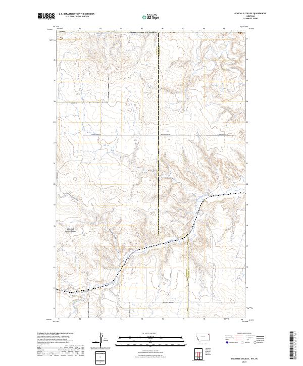
2024 Map of Goodale Coulee
USGS Topo · Published 2024About this map
Whitetail Creek and its tributaries carve a network of drainages across this section of the northeastern Montana plains near the border of Daniels and Sheridan counties. This modern topographic survey highlights a landscape defined by the drainage of Goodale Coulee and its distinct branches, including the North Fork Goodale Coulee and South Fork Goodale Coulee. The terrain is characterized by the rolling elevations of the High Plains, where watercourses like Beaver Creek dictate the local geography.
Find a feature on this map
17 named features on this map. Tap any name to fly to it.
Don’t see what you’re looking for? This feature index may not catch every label — zoom into the map to look around manually.
Map Details
Editions of this 2024 Goodale Coulee Map
This is the sole edition of this map. No revisions or reprints were ever made.
Other maps of this area

1954 · Wolf Point
USGS Topo · 1:250,000

1958 · Wolf Point
USGS Topo · 1:250,000

1973 · Flaxville
USGS Topo · 1:24,000

1973 · Whitetail
USGS Topo · 1:24,000

1973 · Navajo
USGS Topo · 1:24,000

1973 · Goodale Coulee
USGS Topo · 1:24,000
1983 · Daleview
USGS Topo · 1:24,000

1983 · Redstone
USGS Topo · 1:24,000

1983 · Scobey
USGS Topo · 1:100,000
2011 · Daleview
USGS Topo · 1:24,000