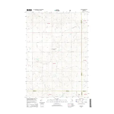
2014 Map of Goodar
USGS Topo · Published 2014About this map
The Huron National Forest dominates this landscape in northeast Michigan, where the village of Goodar sits at the intersection of four counties: Ogemaw, Iosco, Alcona, and Oscoda. The geography is defined by glacial kettle lakes and a network of named drainages including Ninemile Cr and Wilbur Cr. While the terrain remains largely undeveloped forest land, the network of seasonal and forest service roads like Six Mile Grade and Mack Lake Trl indicates the area's ongoing importance for timber management and outdoor recreation. Water features such as Hughes Lake, Redhead Lake, and the cluster known as Three Lakes are prominent landmarks. The map illustrates the convergence of township and range lines, specifically T25N and T24N, marking the transition between different administrative districts in this remote wooded region.
Find a feature on this map
40 named features on this map. Tap any name to fly to it.
Don’t see what you’re looking for? This feature index may not catch every label — zoom into the map to look around manually.
Map Details
Editions of this 2014 Goodar Map
This is the sole edition of this map. No revisions or reprints were ever made.
Other maps of this area

1954 · Traverse City
USGS Topo · 1:250,000

1954 · Tawas City
USGS Topo · 1:250,000

1958 · Traverse City
USGS Topo · 1:250,000

1958 · Tawas City
USGS Topo · 1:250,000

1965 · Rose City
USGS Topo · 1:24,000

1968 · Hale
USGS Topo · 1:24,000

1968 · South Branch
USGS Topo · 1:24,000

1972 · McKinley
USGS Topo · 1:24,000

1972 · Curran
USGS Topo · 1:24,000

1972 · Goodar
USGS Topo · 1:24,000