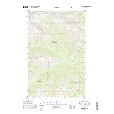
2020 Map of Goode Mountain
USGS Topo · Published 2020About this map
North Cascades National Park and the Wenatchee National Forest converge in this high-altitude landscape dominated by the massive summits of Goode Mtn and Buckner Mtn. The terrain is defined by extreme vertical relief, where several large ice fields including the Buckner Glacier, Goode Glacier, Wyeth Glacier, and Boston Glacier cling to the steep northern faces of the ridges. This environment is characterized by a dense network of glacial runoff, feeding into Park Cr, Flat Creek, and the Stehekin River.
Find a feature on this map
40 named features on this map. Tap any name to fly to it.
Don’t see what you’re looking for? This feature index may not catch every label — zoom into the map to look around manually.
Map Details
Editions of this 2020 Goode Mountain Map
This is the sole edition of this map. No revisions or reprints were ever made.
Other maps of this area

1899 · Glacier Peak
USGS Topo · 1:125,000

1901 · Glacier Peak
USGS Topo · 1:125,000

1902 · Stehekin
USGS Topo · 1:125,000

1904 · Stehekin
USGS Topo · 1:125,000

1920 · Slate Pass
USGS Topo · 1:125,000

1955 · Concrete
USGS Topo · 1:250,000

1958 · Concrete
USGS Topo · 1:250,000

1962 · Concrete
USGS Topo · 1:250,000

1963 · Mc Gregor Mtn
USGS Topo · 1:24,000
1963 · Agnes Mtn
USGS Topo · 1:24,000