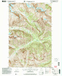
2004 Map of Goode Mountain
USGS Topo · Published 2008About this map
Goode Mountain towers over this section of the High Cascades, where massive ice fields like Boston Glacier and Goode Glacier define the high-altitude geography. The landscape is a complex of deep valleys and sharp ridges, including Goode Ridge and Flat Creek Ridge, which divide the drainages of the Stehekin River and its various forks. Human presence is limited to backcountry infrastructure, with the Park Creek Trail providing a route through Park Creek Pass between the peaks of Buckner Mountain and Storm King. This 2004 revision by the USDA Forest Service documents the wilderness boundaries of the North Cascades National Park and Wenatchee National Forest. Remote sites such as Cottonwood Campsite and Park Creek Campsite serve as the primary landmarks for those navigating the valley floors, while high-altitude water bodies like Trapper Lake and Glory Lake sit isolated in the upper cirques.
Find a feature on this map
44 named features on this map. Tap any name to fly to it.
Don’t see what you’re looking for? This feature index may not catch every label — zoom into the map to look around manually.
Map Details
Editions of this 2004 Goode Mountain Map
This is the sole edition of this map. No revisions or reprints were ever made.
Other maps of this area

1899 · Glacier Peak
USGS Topo · 1:125,000

1901 · Glacier Peak
USGS Topo · 1:125,000

1902 · Stehekin
USGS Topo · 1:125,000

1904 · Stehekin
USGS Topo · 1:125,000

1920 · Slate Pass
USGS Topo · 1:125,000

1955 · Concrete
USGS Topo · 1:250,000

1958 · Concrete
USGS Topo · 1:250,000

1962 · Concrete
USGS Topo · 1:250,000

1963 · Mc Gregor Mtn
USGS Topo · 1:24,000
1963 · Agnes Mtn
USGS Topo · 1:24,000