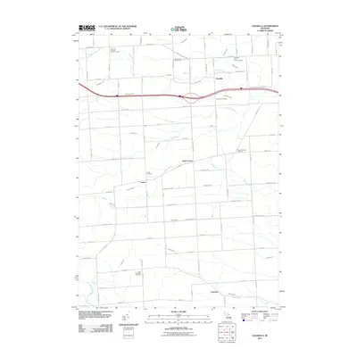
2011 Map of Goodells
USGS Topo · Published 2011About this map
Goodells and its surrounding townships in St. Clair County are characterized by a dense network of agricultural drains and small waterways in this early 21st-century study. The South Branch Pine River and Belle River anchor the drainage system, which is supplemented by numerous named channels like Riley-Wales Drain and Johnson Drain. The map documents several small, established communities including Wales Center, Lambs, and Columbus, each serving as local hubs for the rural landscape. Genealogists will find this particular survey invaluable for its clear marking of local burial grounds, ranging from the Our Lady of Mount Carmel Cemetery in the north to the Saint Philip Neri Cemetery in the south. The location of the Goodells Poor Farm Cemetery provides a specific historical touchpoint for the county's social history and municipal land use during this period.
Find a feature on this map
78 named features on this map. Tap any name to fly to it.
Don’t see what you’re looking for? This feature index may not catch every label — zoom into the map to look around manually.
Map Details
Editions of this 2011 Goodells Map
This is the sole edition of this map. No revisions or reprints were ever made.
Other maps of this area

1914 · Armada
USGS Topo · 1:62,500

1928 · Armada
USGS Topo · 1:62,500

1928 · Hicky
USGS Topo · 1:62,500

1936 · Rattle Run
USGS Topo · 1:31,680

1939 · Adair
USGS Topo · 1:24,000

1939 · Smiths Creek
USGS Topo · 1:24,000

1939 · Goodells
USGS Topo · 1:24,000

1942 · Rattle Run
USGS Topo · 1:24,000

1944 · Memphis
USGS Topo · 1:24,000

1945 · Richmond
USGS Topo · 1:24,000