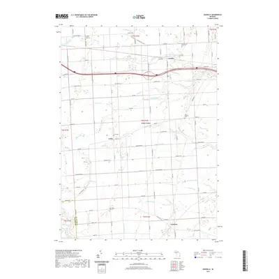
2019 Map of Goodells
USGS Topo · Published 2019About this map
The S Br Pine River and Belle River carve through this section of St. Clair County, defining a landscape marked by small agricultural settlements and a dense network of named drainage systems. This 2019 survey documents the rural character of communities like Goodells, Wales Center, Lambs, and Columbus. For local historians and genealogists, the map provides precise locations for several distinct burial grounds, including the Goodells Poor Farm Cem and Our Lady of Mount Carmel Cem. The drainage infrastructure is notably intricate, with features such as the Riley-Wales Drain, Neaton Drain, and Wonderlic Drain illustrating the long-standing efforts to manage the water table for the region's farmland. This map provides a contemporary record of the property boundaries and road networks that have shaped this Michigan countryside for generations.
Find a feature on this map
86 named features on this map. Tap any name to fly to it.
Don’t see what you’re looking for? This feature index may not catch every label — zoom into the map to look around manually.
Map Details
Editions of this 2019 Goodells Map
This is the sole edition of this map. No revisions or reprints were ever made.
Other maps of this area

1914 · Armada
USGS Topo · 1:62,500

1928 · Armada
USGS Topo · 1:62,500

1928 · Hicky
USGS Topo · 1:62,500

1936 · Rattle Run
USGS Topo · 1:31,680

1939 · Adair
USGS Topo · 1:24,000

1939 · Smiths Creek
USGS Topo · 1:24,000

1939 · Goodells
USGS Topo · 1:24,000

1942 · Rattle Run
USGS Topo · 1:24,000

1944 · Memphis
USGS Topo · 1:24,000

1945 · Richmond
USGS Topo · 1:24,000