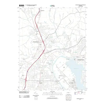
2010 Map of Goodlettsville
USGS Topo · Published 2010About this map
Old Hickory and Goodlettsville anchor this 2010 survey of the northern Nashville suburbs, where the industrial legacy of the Cumberland River meets modern residential growth. The landscape is defined by the massive impoundment of Old Hickory Lake, created by the Old Hickory Dam, which transformed the river into a major recreational and utility resource. Traces of the region's earlier infrastructure remain visible in landmarks like the Old Stone Bridge and the historical rail points at Amqui and Edenwold.
Find a feature on this map
73 named features on this map. Tap any name to fly to it.
Don’t see what you’re looking for? This feature index may not catch every label — zoom into the map to look around manually.
Map Details
Editions of this 2010 Goodlettsville Map
This is the sole edition of this map. No revisions or reprints were ever made.
Other maps of this area

1903 · Nashville
USGS Topo · 1:125,000

1931 · Ridgetop
USGS Topo · 1:62,500

1932 · Hermitage
USGS Topo · 1:62,500

1932 · Nashville
USGS Topo · 1:62,500

1935 · Ridgetop
USGS Topo · 1:62,500

1942 · Gallatin
USGS Topo · 1:100,000

1942 · Lebanon
USGS Topo · 1:100,000

1952 · Goodlettsville
USGS Topo · 1:24,000

1952 · Hendersonville
USGS Topo · 1:24,000

1952 · Hermitage
USGS Topo · 1:24,000