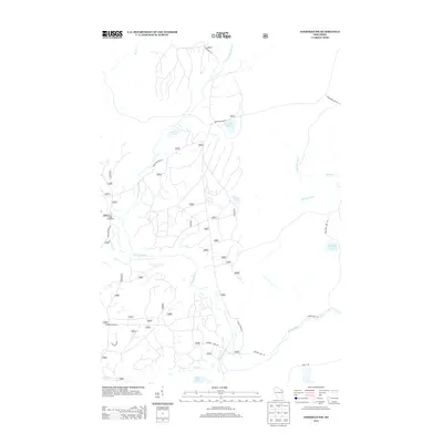
2013 Map of Goodman SW
USGS Topo · Published 2013About this map
The Peshtigo River winds through this heavily forested portion of Forest County, defining the drainage patterns for numerous smaller tributaries like Armstrong Creek and Michigan Creek. This 2013 U.S. Geological Survey update highlights a landscape dominated by timber management and recreation, evidenced by the network of forest roads such as Forest Rd 2371 and Michigan Creek Rd. Remote water bodies are scattered throughout the terrain, including the evocatively named Revolver Lake, Camp Six Lake, and Porcupine Lake. The presence of the Burnt Bridge Campground and the access provided by Goodman Park Rd suggest the area's importance for public outdoor use within the regional forest system. The hydrology is particularly detailed, showing the headwaters and branches of Harvey Creek and Goose Creek.
Find a feature on this map
23 named features on this map. Tap any name to fly to it.
Don’t see what you’re looking for? This feature index may not catch every label — zoom into the map to look around manually.
Map Details
Editions of this 2013 Goodman SW Map
This is the sole edition of this map. No revisions or reprints were ever made.
Other maps of this area

1939 · Goodman
USGS Topo · 1:48,000

1939 · Laona
USGS Topo · 1:48,000

1940 · Thunder Mtn.
USGS Topo · 1:48,000

1942 · Wabeno
USGS Topo · 1:48,000

1946 · Laona
USGS Topo · 1:48,000

1946 · Goodman
USGS Topo · 1:48,000

1950 · Wabeno
USGS Topo · 1:48,000

1951 · Wabeno
USGS Topo · 1:48,000

1951 · Thunder Mountain
USGS Topo · 1:48,000

1954 · Iron Mountain
USGS Topo · 1:250,000