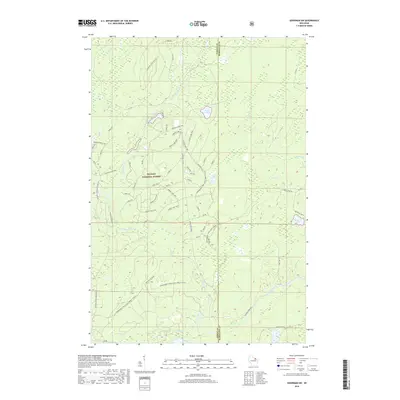
2018 Map of Goodman SW
USGS Topo · Published 2018About this map
The Nicolet National Forest spans much of this area on the border of Forest and Marinette counties, defined by a dense network of water bodies and seasonal trails. The Peshtigo River winds through the southern half of the quadrangle, joined by tributaries such as Michigan Cr and Armstrong Creek. This landscape is dotted with small, isolated lakes including Camp Six Lake, Revolver Lake, and Porcupine Lake, many of which are accessible only via forestry roads like Peshtigo River Road and Goose Lake Hwt. The abundance of named creeks and the presence of the Snowmobile Trail Lkln Forest (Snow) illustrate a region dedicated to timber management and winter recreation. Researchers can trace the established boundaries and the intricate system of Forest Service routes that provide access to these remote northern Wisconsin wetlands and timberlands.
Find a feature on this map
29 named features on this map. Tap any name to fly to it.
Don’t see what you’re looking for? This feature index may not catch every label — zoom into the map to look around manually.
Map Details
Editions of this 2018 Goodman SW Map
This is the sole edition of this map. No revisions or reprints were ever made.
Other maps of this area

1939 · Goodman
USGS Topo · 1:48,000

1939 · Laona
USGS Topo · 1:48,000

1940 · Thunder Mtn.
USGS Topo · 1:48,000

1942 · Wabeno
USGS Topo · 1:48,000

1946 · Laona
USGS Topo · 1:48,000

1946 · Goodman
USGS Topo · 1:48,000

1950 · Wabeno
USGS Topo · 1:48,000

1951 · Wabeno
USGS Topo · 1:48,000

1951 · Thunder Mountain
USGS Topo · 1:48,000

1954 · Iron Mountain
USGS Topo · 1:250,000