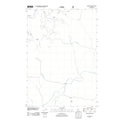
2011 Map of Goodrich
USGS Topo · Published 2011About this map
Goodrich and Bacon anchor the local geography of this Washington County landscape, where the Weiser River winds through a valley defined by significant water management and rural landmarks. The presence of the Glenn Gallant Dam along Bacon Creek highlights the development of local water resources, supporting the surrounding agricultural and ranching operations. The terrain transitions from the low-lying reaches of Greasewood Flat to the more complex drainages of Orchid Canyon and Long Gulch.
Find a feature on this map
25 named features on this map. Tap any name to fly to it.
Don’t see what you’re looking for? This feature index may not catch every label — zoom into the map to look around manually.
Map Details
Editions of this 2011 Goodrich Map
This is the sole edition of this map. No revisions or reprints were ever made.
Other maps of this area

1911 · Meadows
USGS Topo · 1:125,000

1954 · Council
USGS Topo · 1:62,500

1954 · New Meadows
USGS Topo · 1:62,500

1955 · Baker
USGS Topo · 1:250,000

1957 · Cambridge
USGS Topo · 1:62,500

1957 · Hornet
USGS Topo · 1:62,500

1959 · Baker
USGS Topo · 1:250,000

1980 · McCall
USGS Topo · 1:100,000

1986 · Peck Mountain
USGS Topo · 1:24,000
1986 · Indian Valley
USGS Topo · 1:24,000