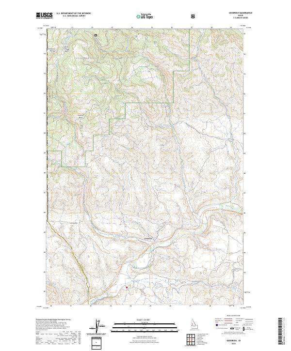
2024 Map of Goodrich
USGS Topo · Published 2024About this map
The settlement of Goodrich is the central hub of this terrain where the Weiser River valley meets the foothills of the Cuddy Mountains. The landscape transitions from the protected timberlands of the Payette National Forest in the north to the ranching and riparian corridors along Goodrich Creek and Bacon Creek. Notable for its recreational and transit history, the map traces the Weiser River National Recreation Trail as it follows the river’s path, mirroring the network of backcountry routes like Cow Creek Rd and Jackson Creek Rd. Geologic and water features such as Ferguson Basin, Skunk Cabbage Flat, and Strawberry Spring provide specific landmarks for understanding the area's hydrology and historical land use. This survey also documents the administrative boundary between Adams and Washington counties, illustrating how the natural topography has influenced political divisions.
Find a feature on this map
35 named features on this map. Tap any name to fly to it.
Don’t see what you’re looking for? This feature index may not catch every label — zoom into the map to look around manually.
Map Details
Editions of this 2024 Goodrich Map
This is the sole edition of this map. No revisions or reprints were ever made.
Other maps of this area

1911 · Meadows
USGS Topo · 1:125,000

1954 · Council
USGS Topo · 1:62,500

1954 · New Meadows
USGS Topo · 1:62,500

1955 · Baker
USGS Topo · 1:250,000

1957 · Cambridge
USGS Topo · 1:62,500

1957 · Hornet
USGS Topo · 1:62,500

1959 · Baker
USGS Topo · 1:250,000

1980 · McCall
USGS Topo · 1:100,000

1986 · Peck Mountain
USGS Topo · 1:24,000
1986 · Indian Valley
USGS Topo · 1:24,000