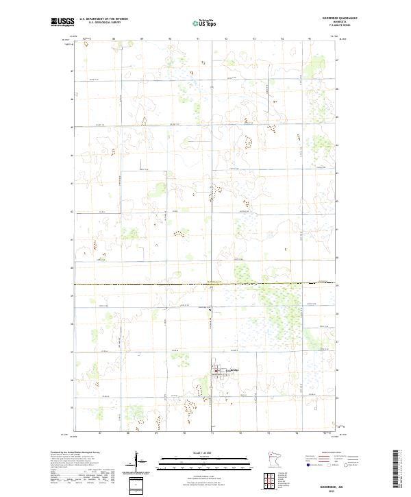
2022 Map of Goodridge
USGS Topo · Published 2022About this map
The city of Goodridge serves as the primary hub in this portion of northwestern Minnesota, situated along the county line where Marshall Co and Pennington Co meet. The landscape is defined by the wandering path of the Lost River in the north and a grid of rural section roads, including Co Hwy 9 and Co Hwy 129, which facilitate the region's agricultural movement. Local infrastructure is concentrated in the town center, featuring the Po and residential corridors such as Brandenberg St E. To the north of the settlement, the Goodridge Cem provides a point of genealogical interest for those tracing family history in the township. The surrounding terrain is characterized by expansive wetlands and low-lying areas typical of the Red River Valley’s eastern edge, where the natural drainage of the Lost River remains a central geographical feature.
Find a feature on this map
33 named features on this map. Tap any name to fly to it.
Don’t see what you’re looking for? This feature index may not catch every label — zoom into the map to look around manually.
Map Details
Editions of this 2022 Goodridge Map
This is the sole edition of this map. No revisions or reprints were ever made.
Other maps of this area

1918 · Rollis
USGS Topo · 1:62,500

1919 · Liner
USGS Topo · 1:62,500

1943 · Rollis
USGS Topo · 1:62,500

1954 · Roseau
USGS Topo · 1:250,000

1957 · Roseau
USGS Topo · 1:250,000

1958 · Roseau
USGS Topo · 1:250,000

1962 · Gatzke SE
USGS Topo · 1:24,000
1962 · Gatzke SW
USGS Topo · 1:24,000

1972 · Erie
USGS Topo · 1:24,000
1972 · Goodridge SW
USGS Topo · 1:24,000