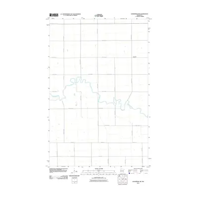
2010 Map of Goodridge SW
USGS Topo · Published 2010About this map
The winding Red Lake River creates a serpentine pattern across this section of Pennington County, carving through a landscape defined by an orderly grid of rural roads and county highways. The river's frequent oxbows and meanders dominate the central portion of the map, illustrating the natural drainage patterns that have shaped agricultural land use in this part of northern Minnesota. This 2010 survey by the U.S. Geological Survey preserves the locations of local landmarks such as the Telemarken Cemetery situated in the northeast near County Hwy-89. The infrastructure is characterized by a network of well-defined corridors including County Hwy-22 and County Hwy-81, which facilitate movement between the widely dispersed farmsteads and rural properties throughout the quadrangle.
Find a feature on this map
25 named features on this map. Tap any name to fly to it.
Don’t see what you’re looking for? This feature index may not catch every label — zoom into the map to look around manually.
Map Details
Editions of this 2010 Goodridge SW Map
This is the sole edition of this map. No revisions or reprints were ever made.
Other maps of this area

1918 · Terrebonne
USGS Topo · 1:62,500

1919 · Grit
USGS Topo · 1:62,500

1943 · Thief River Falls
USGS Topo · 1:62,500

1952 · Grand Forks
USGS Topo · 1:250,000

1952 · Thief River Falls
USGS Topo · 1:250,000

1954 · Bemidji
USGS Topo · 1:250,000

1954 · Roseau
USGS Topo · 1:250,000

1956 · Thief River Falls
USGS Topo · 1:250,000

1956 · Grand Forks
USGS Topo · 1:250,000

1957 · Roseau
USGS Topo · 1:250,000