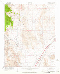
1960 Map of Goodsprings
USGS Topo · Published 1961About this map
Goodsprings stands as a central hub for an expansive mineral district at the base of the Spring Mountains during the early 1960s. The landscape is intensely defined by its extraction history, with dozens of named mines including the Yellow Pine Mine, Prairie Flower Mine, and Monte Cristo Mine dotting the slopes of the Bird Spring Range and Table Mountain. This period shows the transition from early mining infrastructure to modern transport, evidenced by an Old Railroad Grade and a newer Landing Strip near the Union Pacific line. In the flat expanse of the Ivanpah Valley, the settlement of Jean serves the rail corridor adjacent to the dry bed of Jean Lake, while the local Cem and Checking Station provide small but significant markers of community life and regional commerce in Clark County.
Find a feature on this map
70 named features on this map. Tap any name to fly to it.
Don’t see what you’re looking for? This feature index may not catch every label — zoom into the map to look around manually.
Map Details
Editions of this 1960 Goodsprings Map
2 editions found
Other maps of this area

1907 · Las Vegas
USGS Topo · 1:250,000

1908 · Las Vegas
USGS Topo · 1:250,000

1910 · Ivanpah
USGS Topo · 1:250,000

1912 · Ivanpah
USGS Topo · 1:250,000

1942 · Ivanpah
USGS Topo · 1:250,000

1947 · Kingman
USGS Topo · 1:250,000

1948 · Kingman
USGS Topo · 1:250,000

1952 · Blue Diamond
USGS Topo · 1:62,500

1952 · Las Vegas
USGS Topo · 1:62,500

1954 · Las Vegas
USGS Topo · 1:250,000