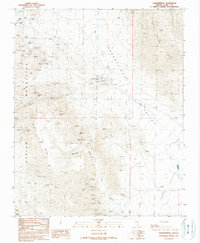
1989 Map of Goodsprings
USGS Topo · Published 1990About this map
Goodsprings serves as the focal point for this high-desert region, surrounded by an extensive network of mining operations that define its local economy and landscape. The terrain is marked by the Spring Mountains to the west and the Bird Spring Range to the east, with the Goodsprings Valley running between them. This map documents a high density of industrial sites, including the Yellow Pine Mine, Monte Cristo Mine, and the Prairie Flower Mine. An Old Railroad Grade winds through the hills, tracing the path of former ore transport. This level of detail provides an intricate look at the distribution of claims and shafts, such as the Ruth Mine and Houghton Mine, which are scattered among natural landmarks like Columbia Pass and Table Mountain.
Find a feature on this map
51 named features on this map. Tap any name to fly to it.
Don’t see what you’re looking for? This feature index may not catch every label — zoom into the map to look around manually.
Map Details
Editions of this 1989 Goodsprings Map
2 editions found
Other maps of this area

1910 · Ivanpah
USGS Topo · 1:250,000

1912 · Ivanpah
USGS Topo · 1:250,000

1942 · Ivanpah
USGS Topo · 1:250,000

1947 · Kingman
USGS Topo · 1:250,000

1948 · Kingman
USGS Topo · 1:250,000

1954 · Kingman
USGS Topo · 1:250,000

1955 · Kingman
USGS Topo · 1:250,000

1955 · Roach Lake
USGS Topo · 1:62,500

1956 · Clark Mountain
USGS Topo · 1:62,500

1956 · Shenandoah Peak
USGS Topo · 1:62,500