
1973 Map of Goodwell NW
USGS Topo · Published 1975About this map
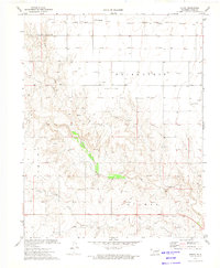
The Beaver River winds through this corner of the Oklahoma Panhandle, carving a distinctive floodplain through the High Plains. The landscape is defined by the intersection of water and industry, with Spring Creek and Tepee Creek feeding into the river basin. Extensive energy development is evident across the terrain, marked by a dense network of Gas Wells that punctuate the plains in nearly every section. The survey reveals a rural economy tied closely to the land, showing multiple extraction sites such as a Caliche Pit and Gravel Pits alongside the natural drainage patterns. This map documents a period of intense resource exploration in the region during the early 1970s, illustrating how local infrastructure followed the paths of these smaller creeks and the larger river valley.
Find a feature on this map
11 named features on this map. Tap any name to fly to it.
Don’t see what you’re looking for? This feature index may not catch every label — zoom into the map to look around manually.
Map Details
Editions of this 1973 Goodwell NW Map
This is the sole edition of this map. No revisions or reprints were ever made.
Other maps of this area

1954 · Perryton
USGS Topo · 1:250,000

1958 · Perryton
USGS Topo · 1:250,000

1973 · Texhoma NE
USGS Topo · 1:24,000

1973 · Goodwell SE
USGS Topo · 1:24,000

1973 · Texhoma North
USGS Topo · 1:24,000

1973 · Eva SE
USGS Topo · 1:24,000

1973 · Hough SW
USGS Topo · 1:24,000

1973 · Goodwell
USGS Topo · 1:24,000

1973 · Goodwell NE
USGS Topo · 1:24,000
1973 · Hough
USGS Topo · 1:24,000