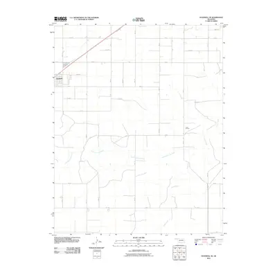
2010 Map of Goodwell SE
USGS Topo · Published 2010About this map
Goodwell sits at the edge of this High Plains landscape, where the rectangular grid of the Oklahoma Panhandle is interrupted by the winding drainage of North Fork Frisco Creek. This 2010 topographic record shows a region defined by a precise section-line road system, with routes like Mile 23 and Rd BB forming the skeletal structure of the local agricultural economy. Farther east, the solitary Frisco Cemetery serves as a significant landmark for those tracing local family histories or seeking the site of earlier community centers. The terrain is relatively flat, yet the erosion patterns of Frisco Creek provide the primary natural relief, carving paths across the grid of section-line roads such as Rd EE and Rd GG as the water flows southeast.
Find a feature on this map
27 named features on this map. Tap any name to fly to it.
Don’t see what you’re looking for? This feature index may not catch every label — zoom into the map to look around manually.
Map Details
Editions of this 2010 Goodwell SE Map
This is the sole edition of this map. No revisions or reprints were ever made.
Other maps of this area

1954 · Perryton
USGS Topo · 1:250,000

1958 · Perryton
USGS Topo · 1:250,000

1968 · Guymon
USGS Topo · 1:24,000

1968 · Guymon SW
USGS Topo · 1:24,000

1973 · Goodwell SE
USGS Topo · 1:24,000

1973 · Goodwell NW
USGS Topo · 1:24,000

1973 · Goodwell
USGS Topo · 1:24,000

1973 · Goodwell NE
USGS Topo · 1:24,000

1974 · Sunray 1 NW
USGS Topo · 1:24,000

1974 · Sunray 1 NE
USGS Topo · 1:24,000