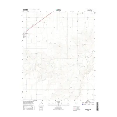
2016 Map of Goodwell SE
USGS Topo · Published 2016About this map
Goodwell serves as the primary focal point on this High Plains landscape, with a grid of residential streets including Jefferson Ave, Lincoln Ave, and Pecan St concentrated in the northwest corner. The surrounding terrain is defined by a series of drainage systems, most notably the winding paths of Frisco Creek and its tributary, N Fork Frisco Cr. The presence of the Frisco Cem several miles east of the town center offers a specific point of interest for genealogists tracing local families. While the northern portion of the map is dominated by the linear geometry of agricultural roads like Co RD Aa and the passage of Dry Sand Draw, the southern reaches reveal more intricate topography where the land breaks toward the creek beds. This 2016 survey reflects the persistent settlement patterns and rural infrastructure of the Oklahoma Panhandle.
Find a feature on this map
39 named features on this map. Tap any name to fly to it.
Don’t see what you’re looking for? This feature index may not catch every label — zoom into the map to look around manually.
Map Details
Editions of this 2016 Goodwell SE Map
This is the sole edition of this map. No revisions or reprints were ever made.
Other maps of this area

1954 · Perryton
USGS Topo · 1:250,000

1958 · Perryton
USGS Topo · 1:250,000

1968 · Guymon
USGS Topo · 1:24,000

1968 · Guymon SW
USGS Topo · 1:24,000

1973 · Goodwell SE
USGS Topo · 1:24,000

1973 · Goodwell NW
USGS Topo · 1:24,000

1973 · Goodwell
USGS Topo · 1:24,000

1973 · Goodwell NE
USGS Topo · 1:24,000

1974 · Sunray 1 NW
USGS Topo · 1:24,000

1974 · Sunray 1 NE
USGS Topo · 1:24,000