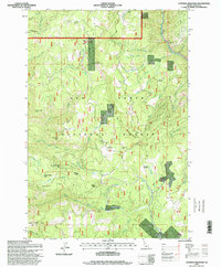
1995 Map of Goodwin Meadows
USGS Topo · Published 1999About this map
Nez Perce National Forest dominates this Idaho landscape, where the South Fork Clearwater River carves through the northeastern corner near McAllister. The terrain is defined by complex ridges and meadows, including Goodwin Meadows and Fish Creek Meadow. These high-elevation clearings provided essential grazing and transit points for early Forest Service operations, evidenced by the presence of White Bird Station and the Fish Creek Lookout Tower.
Find a feature on this map
48 named features on this map. Tap any name to fly to it.
Don’t see what you’re looking for? This feature index may not catch every label — zoom into the map to look around manually.
Map Details
Editions of this 1995 Goodwin Meadows Map
This is the sole edition of this map. No revisions or reprints were ever made.
Other maps of this area

1931 · Buffalo Hump
USGS Topo · 1:125,000

1934 · Buffalo Hump
USGS Topo · 1:125,000

1955 · Grangeville
USGS Topo · 1:250,000

1956 · Elk City
USGS Topo · 1:250,000

1959 · Grangeville
USGS Topo · 1:250,000

1960 · Elk City
USGS Topo · 1:250,000

1963 · McKinzie Creek
USGS Topo · 1:24,000

1963 · Goodwin Meadows
USGS Topo · 1:24,000

1963 · Grangeville West
USGS Topo · 1:24,000

1963 · White Bird Hill
USGS Topo · 1:24,000