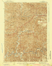
1943 Map of Goodwin Peak
USGS Topo · Published 1943About this map
The Siuslaw National Forest dominates this mid-century landscape where Lane and Douglas counties meet. The complex topography is defined by high peaks such as Goodwin Peak and the curiously named Mt Popocatepetl, while human activity clings to the deep river valleys. Along the winding Smith River and the North Fork Smith River, small pockets of settlement appear through established holdings like Townsend Ranch and Dailey Ranch.
Find a feature on this map
65 named features on this map. Tap any name to fly to it.
Don’t see what you’re looking for? This feature index may not catch every label — zoom into the map to look around manually.
Map Details
Editions of this 1943 Goodwin Peak Map
3 editions found

Other maps of this area

1918 · Mapleton
USGS Topo · 1:48,000

1919 · Earl
USGS Topo · 1:48,000

1920 · Siltcoos Lake
USGS Topo · 1:62,500

1920 · Heceta Head
USGS Topo · 1:62,500

1923 · Reedsport
USGS Topo · 1:62,500

1940 · Mapleton
USGS Topo · 1:62,500

1941 · Blachly
USGS Topo · 1:62,500

1941 · Siltcoos Lake
USGS Topo · 1:62,500

1942 · Blachly
USGS Topo · 1:62,500

1942 · Heceta Head
USGS Topo · 1:62,500