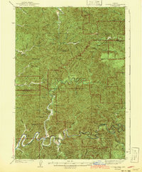
1943 Map of Goodwin Peak
USGS Topo · Published 1943About this map
Goodwin Pk Lookout stands as a central sentinel over the densely forested ridges of the Coast Range during the late 1930s. This survey, compiled from work by C.A. Ecklund and others, details a landscape defined by the deep incisions of the Smith River and the North Fork Siuslaw River. The drainage patterns reveal a rugged, isolated geography where human presence is concentrated in small clearings along the winding riverbanks.
Find a feature on this map
44 named features on this map. Tap any name to fly to it.
Don’t see what you’re looking for? This feature index may not catch every label — zoom into the map to look around manually.
Map Details
Editions of this 1943 Goodwin Peak Map
3 editions found

Other maps of this area

1918 · Mapleton
USGS Topo · 1:48,000

1919 · Earl
USGS Topo · 1:48,000

1920 · Siltcoos Lake
USGS Topo · 1:62,500

1920 · Heceta Head
USGS Topo · 1:62,500

1923 · Reedsport
USGS Topo · 1:62,500

1940 · Mapleton
USGS Topo · 1:62,500

1941 · Blachly
USGS Topo · 1:62,500

1941 · Siltcoos Lake
USGS Topo · 1:62,500

1942 · Blachly
USGS Topo · 1:62,500

1942 · Heceta Head
USGS Topo · 1:62,500