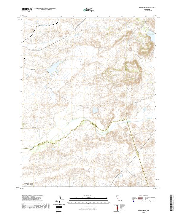
2022 Map of Goose Creek
USGS Topo · Published 2022About this map
The rolling transition where the Sacramento Valley meets the Sierra foothills is defined by a dense network of seasonal drainages and creek beds. This landscape, part of the broader Central Valley, is characterized by the meandering courses of Dry Creek and its tributaries, including Hadselville Cr and Browns Cr. The map reveals a rural infrastructure where county lines intersect in the open country, specifically at the juncture of Sacramento, San Joaquin, and Amador Counties.
Find a feature on this map
22 named features on this map. Tap any name to fly to it.
Don’t see what you’re looking for? This feature index may not catch every label — zoom into the map to look around manually.
Map Details
Editions of this 2022 Goose Creek Map
This is the sole edition of this map. No revisions or reprints were ever made.
Other maps of this area

1889 · Jackson
USGS Topo · 1:125,000

1892 · Jackson
USGS Topo · 1:125,000

1894 · Lodi
USGS Topo · 1:125,000

1897 · Jackson
USGS Topo · 1:125,000

1902 · Jackson
USGS Topo · 1:125,000

1908 · Lockeford
USGS Topo · 1:31,680

1909 · Carbondale
USGS Topo · 1:31,680

1909 · Clay
USGS Topo · 1:31,680

1909 · Cosumnes
USGS Topo · 1:31,680

1909 · Goose Creek
USGS Topo · 1:31,680