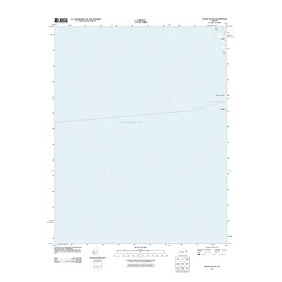
2011 Map of Goose Island
USGS Topo · Published 2011About this map
Tangier Island and its surrounding waters define this coastal survey of the lower Chesapeake Bay. The map focuses on the narrow, low-lying landforms of the northern reaches of the island, where the settlement of Tangier meets the marshy landscape of The Flats. The relationship between the remote island community and the sea is evident in the vital waterways like Tangier North Channel and Goose Harbor, which provide access to the isolated landmasses of Goose Island and Rum Point. This 2011 edition provides a precise look at the shifting shorelines of these vulnerable islands before more recent environmental changes, documenting a uniquely maritime way of life where the boundary between land and water is constantly in flux.
Find a feature on this map
8 named features on this map. Tap any name to fly to it.
Don’t see what you’re looking for? This feature index may not catch every label — zoom into the map to look around manually.
Map Details
Editions of this 2011 Goose Island Map
This is the sole edition of this map. No revisions or reprints were ever made.
Other maps of this area

1903 · Crisfield
USGS Topo · 1:62,500

1917 · Ewell
USGS Topo · 1:62,500

1920 · Crisfield
USGS Topo · 1:62,500

1942 · Nandua Creek
USGS Topo · 1:24,000

1942 · Ewell
USGS Topo · 1:24,000

1942 · Great Fox Island
USGS Topo · 1:24,000

1942 · Tangier Island
USGS Topo · 1:24,000
1943 · Ewell
USGS Topo · 1:31,680
1943 · Great Fox Island
USGS Topo · 1:31,680
1943 · Tangier Island
USGS Topo · 1:31,680