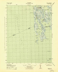
1943 Map of Ewell
USGS Topo · Published 1943About this map
Smith Island dominates this maritime survey, illustrating the complex network of guts, ditches, and thorofares that defined life in the mid-Chesapeake during the 1940s. Centered on the isolated settlements of Ewell, Rhodes Point, and Tylerton, the map reveals a landscape where water and land are inextricably linked. The intricate waterways, such as the Canal and Tyler Ditch, show the intentional engineering required to navigate these low-lying marshes. The southern portion of the island is bisected by the Maryland-Virginia state line, cutting across the marshy expanse near Amen Corner and South Point. Offshore features like Smith Island Light and the small outcroppings of Fishbone Island and Upper Tump highlight the hazards and landmarks essential for the local crabbing and fishing communities navigating Chesapeake Bay and Kedges Straits.
Find a feature on this map
69 named features on this map. Tap any name to fly to it.
Don’t see what you’re looking for? This feature index may not catch every label — zoom into the map to look around manually.
Map Details
Editions of this 1943 Ewell Map
This is the sole edition of this map. No revisions or reprints were ever made.
Other maps of this area

1898 · St. Marys
USGS Topo · 1:125,000

1903 · Crisfield
USGS Topo · 1:62,500

1903 · Bloodsworth Island
USGS Topo · 1:62,500

1903 · Deal Island
USGS Topo · 1:62,500

1906 · St. Marys
USGS Topo · 1:125,000

1917 · Ewell
USGS Topo · 1:62,500

1920 · Crisfield
USGS Topo · 1:62,500

1942 · Terrapin Sand Point
USGS Topo · 1:24,000

1942 · Kedges Straits
USGS Topo · 1:24,000

1942 · Ewell
USGS Topo · 1:24,000