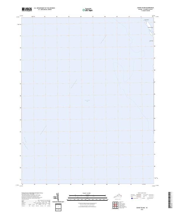
2022 Map of Goose Island
USGS Topo · Published 2022About this map
Chesapeake Bay waters dominate this maritime survey, where the convergence of major waterways defines the geography of the lower Eastern Shore. The map highlights the sparse landforms remaining at the mouth of the Little Annemessex River, including the narrow stretch of Goose Island and the adjacent shoreline at Rum Point. This specific coastal perspective captures the transition from the expansive bay into the tidal channels of the Potomac River and Little Wicomico River. The presence of The Flats underscores the shallow, shifting bathymetry characteristic of this region, providing essential context for those studying the evolving shoreline and maritime hazards in Accomack County.
Find a feature on this map
7 named features on this map. Tap any name to fly to it.
Don’t see what you’re looking for? This feature index may not catch every label — zoom into the map to look around manually.
Map Details
Editions of this 2022 Goose Island Map
This is the sole edition of this map. No revisions or reprints were ever made.
Other maps of this area

1903 · Crisfield
USGS Topo · 1:62,500

1917 · Ewell
USGS Topo · 1:62,500

1920 · Crisfield
USGS Topo · 1:62,500

1942 · Nandua Creek
USGS Topo · 1:24,000

1942 · Ewell
USGS Topo · 1:24,000

1942 · Great Fox Island
USGS Topo · 1:24,000

1942 · Tangier Island
USGS Topo · 1:24,000
1943 · Ewell
USGS Topo · 1:31,680
1943 · Great Fox Island
USGS Topo · 1:31,680
1943 · Tangier Island
USGS Topo · 1:31,680