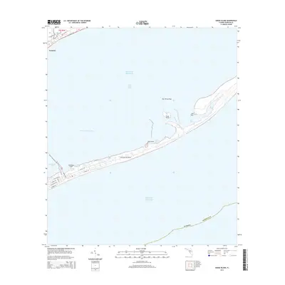
2015 Map of Goose Island
USGS Topo · Published 2015About this map
Saint George Island dominates this coastal survey, stretching across the Gulf of Mexico as a critical barrier between the open sea and the protected waters of Saint George Sound. This narrow strip of land exhibits a developed grid on its western end, including residential thoroughfares like W Gulf Beach Dr and E Gorrie Dr, while the eastern reaches toward Gap Point remain characterized by tidal features like East Slough and East Cove.
Find a feature on this map
31 named features on this map. Tap any name to fly to it.
Don’t see what you’re looking for? This feature index may not catch every label — zoom into the map to look around manually.
Map Details
Editions of this 2015 Goose Island Map
This is the sole edition of this map. No revisions or reprints were ever made.
Other maps of this area

1943 · Apalachicola
USGS Topo · 1:31,680

1943 · Carrabelle
USGS Topo · 1:24,000

1944 · Carrabelle
USGS Topo · 1:31,680

1944 · Green Point
USGS Topo · 1:31,680

1944 · Sugar Hill
USGS Topo · 1:31,680

1944 · Apalachicola
USGS Topo · 1:24,000

1945 · Sugar Hill
USGS Topo · 1:31,680

1945 · Beverly
USGS Topo · 1:31,680

1949 · Apalachicola
USGS Topo · 1:250,000

1950 · Goose Island
USGS Topo · 1:31,680