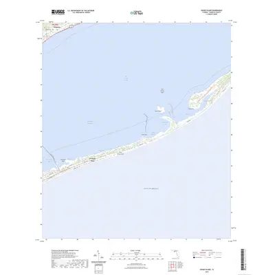
2024 Map of Goose Island
USGS Topo · Published 2024About this map
St. George Island stretches across the lower half of this survey, separating the Gulf of Mexico from the sheltered waters of Saint George Sound and Apalachicola Bay. This barrier island landscape is defined by its narrow, sandy reaches and recreational infrastructure, including the Dr. Julian G. Bruce St. George Island State Park Trail and the Saint George Island Trail. On the mainland to the northwest, the settlement of Eastpoint serves as a coastal hub, featuring the Eastpoint Cemetery and access to the Intracoastal Waterway. The map details a complex coastal ecology where small water bodies like Sams Bayou and Rattlesnake Cove provide transitions between the land and the larger sound. Long-distance recreation is noted via the Florida Circumnavigational Paddling Trail, which winds through the sound and past landmarks such as Goose Island and Gap Point.
Find a feature on this map
29 named features on this map. Tap any name to fly to it.
Don’t see what you’re looking for? This feature index may not catch every label — zoom into the map to look around manually.
Map Details
Editions of this 2024 Goose Island Map
This is the sole edition of this map. No revisions or reprints were ever made.
Other maps of this area

1943 · Apalachicola
USGS Topo · 1:31,680

1943 · Carrabelle
USGS Topo · 1:24,000

1944 · Carrabelle
USGS Topo · 1:31,680

1944 · Green Point
USGS Topo · 1:31,680

1944 · Sugar Hill
USGS Topo · 1:31,680

1944 · Apalachicola
USGS Topo · 1:24,000

1945 · Sugar Hill
USGS Topo · 1:31,680

1945 · Beverly
USGS Topo · 1:31,680

1949 · Apalachicola
USGS Topo · 1:250,000

1950 · Goose Island
USGS Topo · 1:31,680