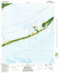
1981 Map of Goose Island
USGS Topo · Published 1982About this map
ST George Island dominates this 1981 orthophotomap, showing the narrow barrier island's delicate topography and coastal infrastructure in the early 1980s. The Bryant Patton Bridge provides the critical link from the mainland at Eastpoint across the St George Sound to Bulkhead Point. This bathymetric study highlights the shifting shoals and underwater features like Porter Bar and Bulkhead Shoal, providing a detailed look at the maritime environment of the Gulf Of Mexico.
Find a feature on this map
23 named features on this map. Tap any name to fly to it.
Don’t see what you’re looking for? This feature index may not catch every label — zoom into the map to look around manually.
Map Details
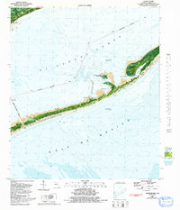
Editions of this 1981 Goose Island Map
2 editions found
Other maps of this area

1943 · Apalachicola
USGS Topo · 1:31,680

1943 · Carrabelle
USGS Topo · 1:24,000

1944 · Carrabelle
USGS Topo · 1:31,680

1944 · Green Point
USGS Topo · 1:31,680

1944 · Sugar Hill
USGS Topo · 1:31,680

1944 · Apalachicola
USGS Topo · 1:24,000

1945 · Sugar Hill
USGS Topo · 1:31,680

1945 · Beverly
USGS Topo · 1:31,680

1949 · Apalachicola
USGS Topo · 1:250,000

1950 · Goose Island
USGS Topo · 1:31,680