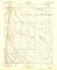
1950 Map of Goose Lake
USGS Topo · Published 1950About this map
Indian Burial Mounds are located throughout this arid landscape, indicating a long history of human presence on the edges of the Goose Lake Bed. By the mid-20th century, the area had transformed into a region defined by extensive water management and ranching. A complex network of irrigation channels, including the Eastside Canal, Westside Canal, and the Goose Lake Canal, crisscrosses the dry lake basin to support local agriculture. This managed landscape is punctuated by isolated homesteads such as Banducci Ranch and Carmel Ranch. The map also reveals the recreational and social life of the era, from the Semitropic Ridge down to the lowlands, featuring the Doheny Gun Club and the Semitropic Sch, serving the scattered rural community of Kern County.
Find a feature on this map
18 named features on this map. Tap any name to fly to it.
Don’t see what you’re looking for? This feature index may not catch every label — zoom into the map to look around manually.
Map Details
Editions of this 1950 Goose Lake Map
This is the sole edition of this map. No revisions or reprints were ever made.
Other maps of this area

1910 · Buena Vista Lake
USGS Topo · 1:125,000

1912 · McKittrick
USGS Topo · 1:125,000

1912 · Buena Vista Lake
USGS Topo · 1:125,000

1914 · Lost Hills
USGS Topo · 1:125,000

1927 · Semitropic
USGS Topo · 1:31,680

1930 · Leonards
USGS Topo · 1:31,680

1930 · Hamlin School
USGS Topo · 1:31,680

1930 · Miramonte Ranch
USGS Topo · 1:31,680

1931 · Lokern
USGS Topo · 1:31,680

1931 · Goose Lake
USGS Topo · 1:31,680