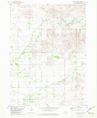
1981 Map of Goose Lake NE
USGS Topo · Published 1982About this map
South Fork Elkhorn River meanders across this rural Nebraska landscape, defining a terrain shaped by the watercourses and sandy soils of Holt County. The 1981 survey documents a sparse agricultural area where small social and religious landmarks like Bethany Ch and the Trussel Cem serve as the primary markers of the local community. The mapping reveals a complex hydrological network including Dry Creek and Cache Creek, alongside numerous flowing wells that dot the township lines. A small industrial footprint is noted near the river via the Claypits, suggesting local resource extraction amidst the section-line roads and irrigation-fed fields of the Sandhills region.
Find a feature on this map
7 named features on this map. Tap any name to fly to it.
Don’t see what you’re looking for? This feature index may not catch every label — zoom into the map to look around manually.
Map Details
Editions of this 1981 Goose Lake NE Map
3 editions found
Other maps of this area

1955 · O'Neill
USGS Topo · 1:250,000

1959 · O'Neill
USGS Topo · 1:250,000

1963 · Ewing SW
USGS Topo · 1:24,000

1963 · Deloit SW
USGS Topo · 1:24,000

1963 · Deloit NW
USGS Topo · 1:24,000

1964 · O'Neill SE
USGS Topo · 1:24,000

1964 · O'Neill SW
USGS Topo · 1:24,000

1969 · O'Neill
USGS Topo · 1:250,000

1981 · Goose Lake SW
USGS Topo · 1:24,000

1981 · Chambers East
USGS Topo · 1:24,000