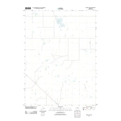
2011 Map of Goose Lake
USGS Topo · Published 2011About this map
Goose Lake serves as a central hydrological landmark in this portion of the Nebraska Sandhills, a landscape defined by its distinctive prairie potholes and wetlands. The map illustrates a rural environment where land use is sparsely punctuated by isolated outposts such as the Mignery Ranch. Water drainage patterns are traced through Cache Creek and Clearwater Creek, while smaller bodies like Detters Lake highlight the characteristic topography of Holt County. The presence of 848th Rd and the diagonal passage of US Highway 281 represent the primary infrastructure connecting these remote ranchlands during the early twenty-first century. This survey documents the persistence of large-scale ranching and the natural hydrography of the region before further modern developments altered the local character.
Find a feature on this map
6 named features on this map. Tap any name to fly to it.
Don’t see what you’re looking for? This feature index may not catch every label — zoom into the map to look around manually.
Map Details
Editions of this 2011 Goose Lake Map
This is the sole edition of this map. No revisions or reprints were ever made.
Other maps of this area

1954 · Bartlett NW
USGS Topo · 1:24,000

1954 · Bartlett
USGS Topo · 1:24,000

1955 · Broken Bow
USGS Topo · 1:250,000

1955 · O'Neill
USGS Topo · 1:250,000

1956 · Broken Bow
USGS Topo · 1:250,000

1959 · O'Neill
USGS Topo · 1:250,000

1960 · Spalding 2 NW
USGS Topo · 1:24,000

1963 · Deloit SW
USGS Topo · 1:24,000

1963 · Deloit NW
USGS Topo · 1:24,000

1969 · O'Neill
USGS Topo · 1:250,000