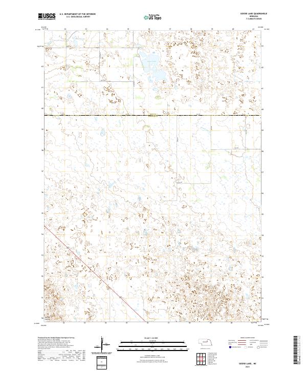
2021 Map of Goose Lake
USGS Topo · Published 2021About this map
Goose Lake and Detters Lake punctuate the Sandhills landscape of this rural Nebraska borderland, situated along the boundary where Holt and Wheeler counties meet. The terrain is characterized by the expansive Buffalo Flats to the southwest and a network of ephemeral watercourses including Cache Cr and Clearwater Cr. This 2021 survey reveals a sparse human footprint, primarily organized by the Public Land Survey System grid of section lines and gravel roads such as 846 Rd and 495th Ave. The map reflects a contemporary snapshot of a ranching environment where large-scale land divisions and natural hydrology dictate the patterns of life and transit.
Find a feature on this map
22 named features on this map. Tap any name to fly to it.
Don’t see what you’re looking for? This feature index may not catch every label — zoom into the map to look around manually.
Map Details
Editions of this 2021 Goose Lake Map
This is the sole edition of this map. No revisions or reprints were ever made.
Other maps of this area

1954 · Bartlett NW
USGS Topo · 1:24,000

1954 · Bartlett
USGS Topo · 1:24,000

1955 · Broken Bow
USGS Topo · 1:250,000

1955 · O'Neill
USGS Topo · 1:250,000

1956 · Broken Bow
USGS Topo · 1:250,000

1959 · O'Neill
USGS Topo · 1:250,000

1960 · Spalding 2 NW
USGS Topo · 1:24,000

1963 · Deloit SW
USGS Topo · 1:24,000

1963 · Deloit NW
USGS Topo · 1:24,000

1969 · O'Neill
USGS Topo · 1:250,000