
1926 Map of Gorda
USGS Topo · Published 1926About this map
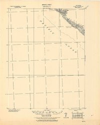
The Pacific Ocean dominates this tactical chart, revealing the precipitous transition from the sea to the coastal peaks of Humboldt County. Produced by the Corps of Engineers, U. S. Army under Col. Thos. H. Jackson, the map emphasizes the maritime hazards and shoreline topography of the mid-1920s. Along the narrow coastline, distinctive landmarks such as Gorda Rock and Reynolds Rock serve as primary navigation points for seafaring vessels. Inland, the terrain rises sharply toward the summit at Gorda 2365, while drainage is defined by steep ravines including Gorda Cr. and Reynolds Cr.. The inclusion of Spanish Flat indicates a rare area of level ground amidst the dramatic coastal contours, providing a valuable reference point for researchers studying historical land use and early coastal surveying along this stretch of Northern California.
Find a feature on this map
8 named features on this map. Tap any name to fly to it.
Don’t see what you’re looking for? This feature index may not catch every label — zoom into the map to look around manually.
Map Details
Editions of this 1926 Gorda Map
2 editions found
Other maps of this area

1919 · Glynn
USGS Topo · 1:62,500

1920 · Pt. Delagda
USGS Topo · 1:62,500

1921 · Cape Mendocino
USGS Topo · 1:62,500

1949 · Eureka
USGS Topo · 1:250,000

1949 · Point Delgada
USGS Topo · 1:62,500

1950 · Cape Mendocino
USGS Topo · 1:62,500

1950 · Scotia
USGS Topo · 1:62,500

1951 · Scotia
USGS Topo · 1:62,500

1951 · Point Delgada
USGS Topo · 1:62,500

1951 · Cape Mendocino
USGS Topo · 1:62,500