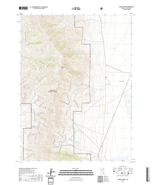
2021 Map of Gordon Creek
USGS Topo · Published 2021About this map
The East Humboldt Range dominates the western half of this 2021 survey, defining a high-elevation landscape within the Humboldt National Forest. From these peaks, numerous drainages like Gordon Creek, Wiseman Creek, and Rockwall Creek descend eastward into the broad basin of Clover Valley. The geography reflects a high-desert hydrological system where isolated water sources are critical landmarks; names like Woolverton Spring, Rattlesnake Spring, and Greek Spring indicate the essential role of groundwater in this arid environment.
Find a feature on this map
73 named features on this map. Tap any name to fly to it.
Don’t see what you’re looking for? This feature index may not catch every label — zoom into the map to look around manually.
Map Details
Editions of this 2021 Gordon Creek Map
This is the sole edition of this map. No revisions or reprints were ever made.
Other maps of this area

1935 · Halleck
USGS Topo · 1:125,000

1953 · Spruce Mountain
USGS Topo · 1:62,500

1955 · Elko
USGS Topo · 1:250,000

1958 · Elko
USGS Topo · 1:250,000

1962 · Elko
USGS Topo · 1:250,000

1965 · Elko
USGS Topo · 1:250,000

1968 · Snow Water Lake
USGS Topo · 1:24,000
1968 · Tobar
USGS Topo · 1:24,000
1969 · Secret Valley
USGS Topo · 1:24,000
1969 · Humboldt Peak
USGS Topo · 1:24,000