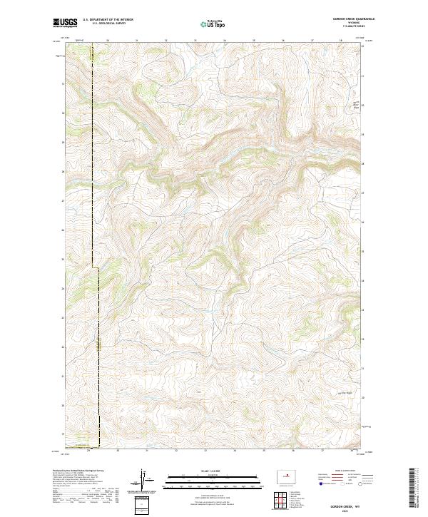
2021 Map of Gordon Creek
USGS Topo · Published 2021About this map
The Middle Fork Powder River carves a central path through this high-altitude landscape on the boundary of Johnson and Washakie Counties. This 2021 survey reveals a complex drainage network where deep canyons and named slopes like North River Slope and Dry Vee Slope define the topography. The map illustrates a watershed dominated by seasonal and perennial flows including Gordon Cr, Sullivan Cr, and the converging waters of Poker Cr and Little Eagle Cr. This is a territory of specialized ranching and public land management, where the physical geography dictates the placement of backcountry access roads and property lines. The detailed hydrography of small tributaries such as Bachaus Cr and Carpenter Cr provides essential spatial data for researchers tracking historical land use and environmental changes in the Powder River Basin region.
Find a feature on this map
22 named features on this map. Tap any name to fly to it.
Don’t see what you’re looking for? This feature index may not catch every label — zoom into the map to look around manually.
Map Details
Editions of this 2021 Gordon Creek Map
This is the sole edition of this map. No revisions or reprints were ever made.
Other maps of this area

1952 · Grave Spring
USGS Topo · 1:24,000

1955 · Arminto
USGS Topo · 1:250,000

1958 · Arminto
USGS Topo · 1:250,000

1961 · Barnum
USGS Topo · 1:62,500

1962 · Arminto
USGS Topo · 1:250,000

1967 · Horse Butte
USGS Topo · 1:24,000

1967 · Gordon Creek
USGS Topo · 1:24,000

1967 · Turk Springs
USGS Topo · 1:24,000
1967 · Cherry Creek Hill
USGS Topo · 1:24,000

1968 · First Water Draw
USGS Topo · 1:24,000