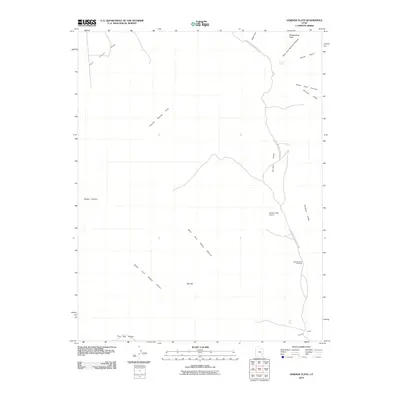
2010 Map of Gordon Flats
USGS Topo · Published 2010About this map
Glen Canyon National Park encompasses a significant portion of this high-desert landscape, where the dramatic vertical relief of the Orange Cliffs meets the expansive Gordon Flats. The map reveals a region defined by complex drainage systems, including the Main Fork and South Fork Happy Canyon, which converge within the larger Happy Canyon system. While the terrain is dominated by natural landmarks like Observation Rock and the curiously named The Hat, human presence is marked by the remote Gordon Flats Airport. Water sources are sparse but critical in this arid environment, noted at French Spring in the north and Flint Seep near the southern boundary. This 2010 survey illustrates the isolation of the Twin Corral Flats and The Big Ridge, providing a clear view of the access points to the Bagpipe Butte Overlook and the deep incisions of East Fork Millard Canyon.
Find a feature on this map
19 named features on this map. Tap any name to fly to it.
Don’t see what you’re looking for? This feature index may not catch every label — zoom into the map to look around manually.
Map Details
Editions of this 2010 Gordon Flats Map
This is the sole edition of this map. No revisions or reprints were ever made.
Other maps of this area

1885 · San Rafael
USGS Topo · 1:250,000

1953 · Orange Cliffs 3 SE
USGS Topo · 1:24,000

1953 · Orange Cliffs 1 SE
USGS Topo · 1:24,000

1953 · Orange Cliffs 4 NW
USGS Topo · 1:24,000

1953 · Orange Cliffs 4 NE
USGS Topo · 1:24,000

1953 · Orange Cliffs 3 NE
USGS Topo · 1:24,000

1953 · Orange Cliffs 4 SW
USGS Topo · 1:24,000

1953 · The Spur
USGS Topo · 1:62,500

1953 · Fiddler Butte
USGS Topo · 1:62,500

1953 · Orange Cliffs
USGS Topo · 1:62,500