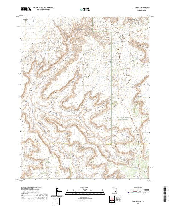
2023 Map of Gordon Flats
USGS Topo · Published 2023About this map
The Wayne and Garfield county line divides this landscape of deep drainages and elevated plateaus within the Glen Canyon National Recreation Area. The topography is defined by the carved paths of the Main Fork and South Fork of Happy Canyon, which contrast with the level terrain of Gordon Flats and Twin Corral Flats. These named flats suggest the area's history as open range for livestock, supported by water sources like French Spring and Flint Seep.
Find a feature on this map
21 named features on this map. Tap any name to fly to it.
Don’t see what you’re looking for? This feature index may not catch every label — zoom into the map to look around manually.
Map Details
Editions of this 2023 Gordon Flats Map
This is the sole edition of this map. No revisions or reprints were ever made.
Other maps of this area

1885 · San Rafael
USGS Topo · 1:250,000

1953 · Orange Cliffs 3 SE
USGS Topo · 1:24,000

1953 · Orange Cliffs 1 SE
USGS Topo · 1:24,000

1953 · Orange Cliffs 4 NW
USGS Topo · 1:24,000

1953 · Orange Cliffs 4 NE
USGS Topo · 1:24,000

1953 · Orange Cliffs 3 NE
USGS Topo · 1:24,000

1953 · Orange Cliffs 4 SW
USGS Topo · 1:24,000

1953 · The Spur
USGS Topo · 1:62,500

1953 · Fiddler Butte
USGS Topo · 1:62,500

1953 · Orange Cliffs
USGS Topo · 1:62,500