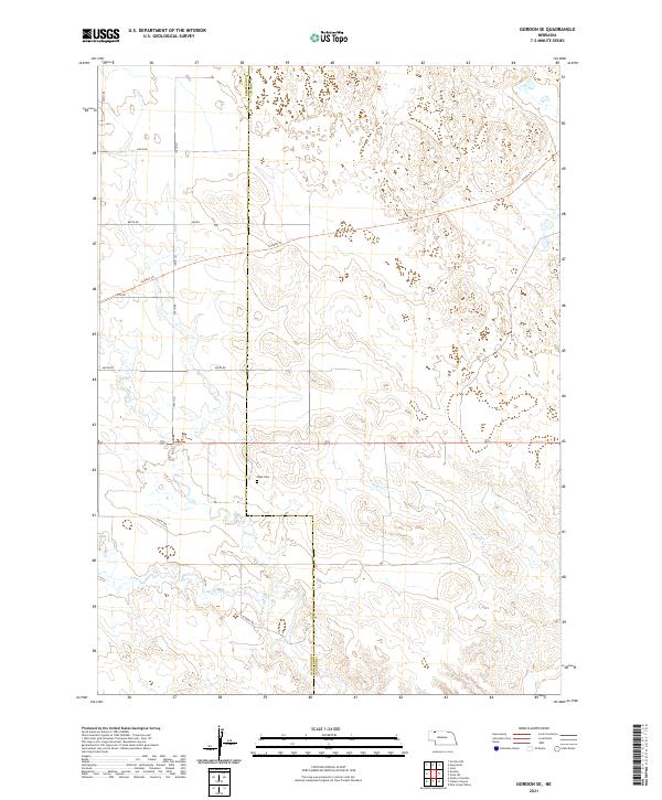
2021 Map of Gordon SE
USGS Topo · Published 2021About this map
Dane Cem sits as a quiet landmark within this expansive Sandhills landscape along the border of Sheridan and Cherry counties. The terrain is defined by the ephemeral drainage of Hay Cr and Antelope Cr, reflecting the hydrologic patterns of northern Nebraska. Modern infrastructure is represented by a network of rural routes including 680 Rd and Schmidt Rd, while the Cowboy Trl cuts a distinct path across the northern sections, following the historic corridor of the Chicago and North Western Railway. This survey captures the region's ranching character, where section lines and isolated trails like 130th Trl provide the primary framework for navigation across the undulating dunes.
Find a feature on this map
17 named features on this map. Tap any name to fly to it.
Don’t see what you’re looking for? This feature index may not catch every label — zoom into the map to look around manually.
Map Details
Editions of this 2021 Gordon SE Map
This is the sole edition of this map. No revisions or reprints were ever made.
Other maps of this area

1950 · Irwin
USGS Topo · 1:62,500

1951 · Irwin
USGS Topo · 1:62,500

1951 · Gypsy Valley
USGS Topo · 1:62,500

1955 · Alliance
USGS Topo · 1:250,000

1957 · Alliance
USGS Topo · 1:250,000

1957 · Valentine
USGS Topo · 1:250,000

1958 · Alliance
USGS Topo · 1:250,000

1959 · Valentine
USGS Topo · 1:250,000

1969 · Gordon
USGS Topo · 1:24,000
1969 · Gordon SE
USGS Topo · 1:24,000