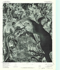
1976 Map of Gordonville NW
USGS Topo · Published 1979About this map
Red River currents and the expansive reach of Lake Texoma dominate this late-1970s orthophotograph, capturing the shifting border between Texas and Oklahoma. The aerial imagery provides a stark, factual view of the shoreline and sandbar formations at the river's mouth, where the water widens into the lake reservoir. On the Oklahoma side of the river, the small rural settlements of Lebanon and Enville appear amidst a landscape of gridded agricultural plots and wooded creek drainages. This specific photographic survey, conducted by the Geological Survey in late 1976, serves as a high-fidelity record of the land use and water levels before subsequent decades of sedimentation and shoreline development. It highlights the intersection of natural river morphology with the engineered environment of the Texoma basin, providing researchers with a clear look at property boundaries and farmstead locations during this era.
Find a feature on this map
4 named features on this map. Tap any name to fly to it.
Don’t see what you’re looking for? This feature index may not catch every label — zoom into the map to look around manually.
Map Details
Editions of this 1976 Gordonville NW Map
This is the sole edition of this map. No revisions or reprints were ever made.
Other maps of this area

1901 · Tishomingo
USGS Topo · 1:125,000

1901 · Ardmore
USGS Topo · 1:125,000

1901 · Denison
USGS Topo · 1:125,000

1902 · Gainesville
USGS Topo · 1:125,000

1918 · Ardmore
USGS Topo · 1:125,000

1943 · Gainesville
USGS Topo · 1:125,000

1954 · Sherman
USGS Topo · 1:250,000

1957 · Ardmore
USGS Topo · 1:250,000

1958 · Gordonville
USGS Topo · 1:62,500

1958 · Sherman
USGS Topo · 1:250,000