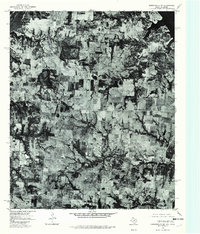
1976 Map of Gordonville SW
USGS Topo · Published 1979About this map
Dexter and Sandusky anchor this rural landscape in North Texas, captured during a 1976 aerial survey by the U.S. Geological Survey in cooperation with the Oklahoma Geological Survey. The orthophotograph reveals a patchwork of agricultural fields and wooded creek bottoms along the Texas-Oklahoma border. Small rural communities like Red Branch and Sturgeon appear as modest clusters of structures connected by a network of winding local roads. This photographic record provides an unfiltered view of land use and vegetation patterns during the mid-1970s, showing the exact footprint of homesteads and farms before decades of modern consolidation. The imagery is particularly useful for researchers tracing family property or the specific layout of cross-border settlements during this era.
Find a feature on this map
4 named features on this map. Tap any name to fly to it.
Don’t see what you’re looking for? This feature index may not catch every label — zoom into the map to look around manually.
Map Details
Editions of this 1976 Gordonville SW Map
This is the sole edition of this map. No revisions or reprints were ever made.
Other maps of this area

1901 · Denison
USGS Topo · 1:125,000

1902 · Gainesville
USGS Topo · 1:125,000

1943 · Gainesville
USGS Topo · 1:125,000

1954 · Sherman
USGS Topo · 1:250,000

1958 · Gordonville
USGS Topo · 1:62,500

1958 · Whitesboro
USGS Topo · 1:62,500

1958 · Sherman
USGS Topo · 1:250,000

1960 · Callisburg
USGS Topo · 1:24,000
1967 · Marietta East
USGS Topo · 1:24,000
1968 · Horseshoe Bend
USGS Topo · 1:24,000