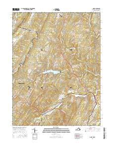
2016 Map of Gore
USGS Topo · Published 2016About this map
Great North Mountain and Timber Ridge dominate this section of the Blue Ridge foothills, where the state line divides the landscape into a pattern of high ridges and narrow valleys. The settlement of Gore serves as a central hub near Point of Rocks, situated along the Northwestern Pike. This corridor is defined by its water and terrain, with Back Creek and its many tributaries, such as Albin Run and Mine Spring Run, cutting through the geology.
Find a feature on this map
50 named features on this map. Tap any name to fly to it.
Don’t see what you’re looking for? This feature index may not catch every label — zoom into the map to look around manually.
Map Details
Editions of this 2016 Gore Map
This is the sole edition of this map. No revisions or reprints were ever made.
Other maps of this area

1894 · Winchester
USGS Topo · 1:125,000

1914 · Gerrardstown
USGS Topo · 1:48,000

1916 · Gerrardstown
USGS Topo · 1:62,500

1916 · Capon Bridge
USGS Topo · 1:62,500

1923 · Middletown
USGS Topo · 1:62,500

1923 · Capon Bridge
USGS Topo · 1:62,500

1937 · Capon Bridge
USGS Topo · 1:48,000

1937 · Gerrardstown
USGS Topo · 1:48,000

1937 · Middletown
USGS Topo · 1:48,000

1938 · Winchester
USGS Topo · 1:48,000