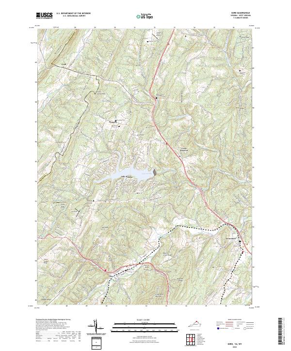
2022 Map of Gore
USGS Topo · Published 2022About this map
Gore and the winding course of the Northwestern Pike anchor this 2022 look at the rugged transition between the Shenandoah Valley and the Allegheny Mountains. The landscape is defined by long, parallel ridges like Timber Ridge and Great North Mountain, which dictate the paths of waterways such as Back Creek and Bloomery Run. A significant portion of the central terrain is occupied by Lake Holiday, a large impoundment surrounded by residential development and the seasonal retreat of Al's Field. For those researching family history, the map is densely annotated with private and community burial sites, including the Heironimus Gravesite, Back Creek Quaker Cemetery, and the Seibert Cemetery near Point of Rocks. The intersection of old turnpikes and modern connectors at Cross Junction and Gainesboro shows the enduring importance of these corridors for commerce and transit across the West Virginia and Virginia state line.
Find a feature on this map
55 named features on this map. Tap any name to fly to it.
Don’t see what you’re looking for? This feature index may not catch every label — zoom into the map to look around manually.
Map Details
Editions of this 2022 Gore Map
This is the sole edition of this map. No revisions or reprints were ever made.
Other maps of this area

1894 · Winchester
USGS Topo · 1:125,000

1914 · Gerrardstown
USGS Topo · 1:48,000

1916 · Gerrardstown
USGS Topo · 1:62,500

1916 · Capon Bridge
USGS Topo · 1:62,500

1923 · Middletown
USGS Topo · 1:62,500

1923 · Capon Bridge
USGS Topo · 1:62,500

1937 · Capon Bridge
USGS Topo · 1:48,000

1937 · Gerrardstown
USGS Topo · 1:48,000

1937 · Middletown
USGS Topo · 1:48,000

1938 · Winchester
USGS Topo · 1:48,000