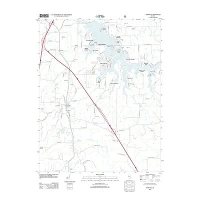
2012 Map of Goreville
USGS Topo · Published 2012About this map
Lake of Egypt dominates the northern half of this landscape, its indented shoreline giving rise to numerous residential developments such as Crestwood, Egypt Shores, and Eagle Point Bay. This intricate network of fingers and coves, including Bethlehem Bay and Shawnee Bay, contrasts with the agricultural and forested lands to the south. The village of Goreville sits as a central hub, with the surrounding countryside dotted by family-named cemeteries that provide a record of local genealogy, including Maneese Cem, Gibson Cem, and Mosley Cem. The southern reaches of the quadrangle transition into the protected acreage of the Shawnee National Forest, where the terrain is marked by Ferne Clyffe Lake and the drainages of Dutchman Cr and Grasshoppers Cr.
Find a feature on this map
120 named features on this map. Tap any name to fly to it.
Don’t see what you’re looking for? This feature index may not catch every label — zoom into the map to look around manually.
Map Details
Editions of this 2012 Goreville Map
This is the sole edition of this map. No revisions or reprints were ever made.
Other maps of this area

1918 · Vienna
USGS Topo · 1:62,500

1919 · Vienna
USGS Topo · 1:62,500

1920 · Dongola
USGS Topo · 1:62,500

1922 · Carbondale
USGS Topo · 1:62,500

1923 · Dongola
USGS Topo · 1:62,500

1925 · Marion
USGS Topo · 1:62,500

1940 · Marion
USGS Topo · 1:62,500

1941 · Carbondale
USGS Topo · 1:62,500

1942 · Vienna
USGS Topo · 1:62,500

1949 · Paducah
USGS Topo · 1:250,000