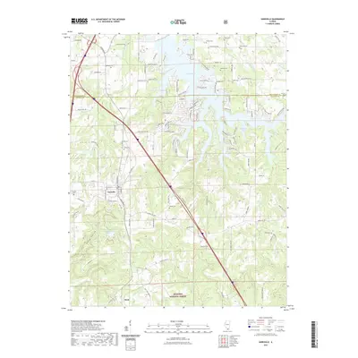
2021 Map of Goreville
USGS Topo · Published 2021About this map
Goreville serves as the central hub of this Southern Illinois landscape, situated at the intersection of a significant local road network and the undulating terrain of the Shawnee National Forest. The map illustrates a transition from the structured street grid of the village, including W Ferne Clyffe St and S Broadway, to the intricate shoreline of the Lake of Egypt in the north. This reservoir is defined by numerous inlets and coves like Bethlehem Bay and Shawnee Bay, where contemporary residential patterns meet the water's edge.
Find a feature on this map
122 named features on this map. Tap any name to fly to it.
Don’t see what you’re looking for? This feature index may not catch every label — zoom into the map to look around manually.
Map Details
Editions of this 2021 Goreville Map
This is the sole edition of this map. No revisions or reprints were ever made.
Other maps of this area

1918 · Vienna
USGS Topo · 1:62,500

1919 · Vienna
USGS Topo · 1:62,500

1920 · Dongola
USGS Topo · 1:62,500

1922 · Carbondale
USGS Topo · 1:62,500

1923 · Dongola
USGS Topo · 1:62,500

1925 · Marion
USGS Topo · 1:62,500

1940 · Marion
USGS Topo · 1:62,500

1941 · Carbondale
USGS Topo · 1:62,500

1942 · Vienna
USGS Topo · 1:62,500

1949 · Paducah
USGS Topo · 1:250,000