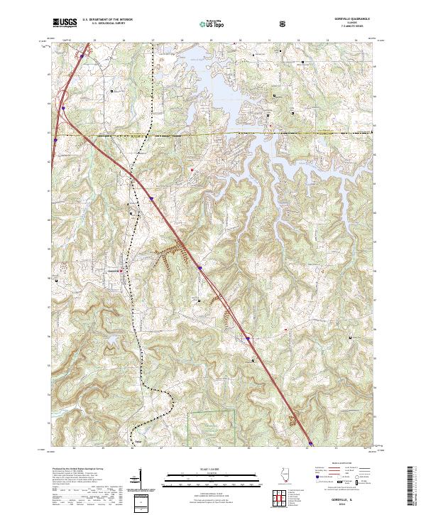
2024 Map of Goreville
USGS Topo · Published 2024About this map
The town of Goreville serves as the focal point for this survey of the northern Ozark plateau region in Illinois. The landscape is defined by the significant footprint of the Shawnee National Forest, which covers much of the southern and central terrain. Water features dominate the geography, from the sprawling reach of the Lake of Egypt in the northeast to the smaller Ferne Clyffe Lake nestled in the southwest. The presence of Luxor Landing and various bays like Bethlehem Bay and Shawnee Bay highlights the region's recreational and residential character around these large impoundments.
Find a feature on this map
127 named features on this map. Tap any name to fly to it.
Don’t see what you’re looking for? This feature index may not catch every label — zoom into the map to look around manually.
Map Details
Editions of this 2024 Goreville Map
This is the sole edition of this map. No revisions or reprints were ever made.
Other maps of this area

1918 · Vienna
USGS Topo · 1:62,500

1919 · Vienna
USGS Topo · 1:62,500

1920 · Dongola
USGS Topo · 1:62,500

1922 · Carbondale
USGS Topo · 1:62,500

1923 · Dongola
USGS Topo · 1:62,500

1925 · Marion
USGS Topo · 1:62,500

1940 · Marion
USGS Topo · 1:62,500

1941 · Carbondale
USGS Topo · 1:62,500

1942 · Vienna
USGS Topo · 1:62,500

1949 · Paducah
USGS Topo · 1:250,000