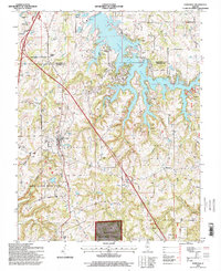
1996 Map of Goreville
USGS Topo · Published 1998About this map
Goreville and the surrounding southern Illinois landscape are defined here by the intricate shoreline of the Lake of Egypt and the wooded terrain of the Shawnee National Forest. The map captures a mid-1990s view of the region's diverse recreation and conservation areas, including the rugged southern parcels of Ferne Clyffe State Park and the Lake of Egypt Recreation Area. The River to River Trail threads through the topography near Omar, linking the state park to the interior forest. For genealogists, the sheet is exceptionally detailed, noting numerous rural landmarks such as McKinney Chapel and family-named burial grounds like Menees Cem, Cocker Cem, and Mosley Cem. These sites, along with the crossroads at Pulleys Mill, preserve the nomenclature of early settlement families even as the modern reservoir and utilities like the lakeside Powerplant transformed the local economy.
Find a feature on this map
42 named features on this map. Tap any name to fly to it.
Don’t see what you’re looking for? This feature index may not catch every label — zoom into the map to look around manually.
Map Details
Editions of this 1996 Goreville Map
This is the sole edition of this map. No revisions or reprints were ever made.
Other maps of this area

1918 · Vienna
USGS Topo · 1:62,500

1919 · Vienna
USGS Topo · 1:62,500

1920 · Dongola
USGS Topo · 1:62,500

1922 · Carbondale
USGS Topo · 1:62,500

1923 · Dongola
USGS Topo · 1:62,500

1925 · Marion
USGS Topo · 1:62,500

1940 · Marion
USGS Topo · 1:62,500

1941 · Carbondale
USGS Topo · 1:62,500

1942 · Vienna
USGS Topo · 1:62,500

1949 · Paducah
USGS Topo · 1:250,000