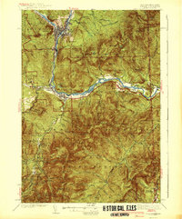
1942 Map of Gorham
USGS Topo · Published 1942About this map
The industrial and mountain landscapes of Coos County meet along the Androscoggin River, where the city of Berlin and the village of Cascade serve as hubs for the region's timber and rail economy. This mid-century survey captures the area during a period of high industrial activity, showing the convergence of the Grand Trunk, Boston and Maine, and Maine Central railroads. These lines follow the river valleys, connecting the mills and settlements to the broader New England network.
Find a feature on this map
107 named features on this map. Tap any name to fly to it.
Don’t see what you’re looking for? This feature index may not catch every label — zoom into the map to look around manually.
Map Details
Editions of this 1942 Gorham Map
3 editions found

Other maps of this area

1893 · Mt. Washington
USGS Topo · 1:62,500

1893 · Gorham
USGS Topo · 1:62,500

1894 · North Conway
USGS Topo · 1:62,500

1895 · Crawford Notch
USGS Topo · 1:62,500

1896 · Mt. Washington
USGS Topo · 1:62,500

1896 · Crawford Notch
USGS Topo · 1:62,500

1896 · North Conway
USGS Topo · 1:62,500

1896 · Gorham
USGS Topo · 1:62,500

1909 · Fryeburg
USGS Topo · 1:62,500

1911 · Fryeburg
USGS Topo · 1:62,500